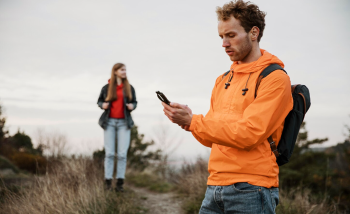
For travelers, hikers, cyclists, surfers, photographers, and anyone whose plans hinge on the sky, having trustworthy, real-time weather data is non-negotiable. A sudden downpour can ruin a city tour, high winds can ground a paragliding session, and unexpected cold snaps can turn a pleasant trail into a survival scenario. The good news? You don’t need to pay for premium subscriptions to stay ahead of the elements. Several free weather apps deliver world-class accuracy, hyper-local forecasts, interactive radar, and life-saving alerts—all at zero cost. This in-depth guide evaluates the best options, breaks down their unique strengths, and shows you how to use them like a pro, whether you’re backpacking through Patagonia or navigating a weekend road trip.
Key Features to Prioritize in a Weather App
The difference between a basic temperature app and a true outdoor companion lies in the depth and relevance of its features. For travelers and adventurers, the following capabilities are essential for safety, planning, and performance.
- Hyper-local and GPS-driven forecasting: Uses your exact coordinates—down to the street or trailhead—to deliver personalized predictions, even in remote valleys or coastal cliffs where traditional stations fall short.
- Severe weather push notifications: Instant alerts for flash floods, lightning strikes, tornado warnings, high wind gusts, or blizzard conditions, with customizable thresholds (e.g., rain > 0.5 in/hr or wind > 30 mph).
- Hourly, daily, and extended outlooks: Detailed 24-hour breakdowns and 10–15 day trends help you schedule sunrise shoots, avoid afternoon thunderstorms, or plan multi-day treks with confidence.
- Interactive, real-time radar and satellite imagery: Animated maps with layered data—precipitation intensity, storm cell movement, cloud cover, and temperature gradients—so you can visually track an approaching front from 100 miles out.
- Offline map and forecast caching: Download radar loops, hourly predictions, and alert zones before entering dead-signal zones like national parks, offshore waters, or international regions with spotty data.
- Environmental and health indices: UV index, air quality (AQI), pollen counts, humidity levels, dew point, and heat index to protect against sunburn, respiratory issues, or heat exhaustion during long exposures.
- Activity-optimized insights: Running index (wind + temp comfort), cycling headwind warnings, hiking heat risk, boating wave height forecasts, or fishing barometric pressure trends.
- Astronomical and tidal data: Precise sunrise/sunset, moon phases, golden hour timing, and tide charts—crucial for landscape photographers, night hikers, and coastal paddlers.
- Historical weather patterns: Access past data (e.g., “average July rainfall in Banff”) to inform packing lists and route choices for seasonal travel.
These features turn a simple forecast into a full-field command center for weather-dependent decision-making.
Top Free Weather Apps for Travel and Outdoor Use
After testing dozens of apps in real-world conditions—from urban marathons to alpine expeditions—these four free weather apps consistently deliver unmatched reliability, depth, and usability.
AccuWeather
- MinuteCast® precision: Forecasts precipitation start/stop times down to the minute for your exact location—perfect for timing a museum dash or trailhead departure before rain hits.
- RealFeel® Temperature: Goes beyond dry-bulb readings to factor in wind chill, humidity, sun intensity, and cloud cover for a true “feels-like” experience.
- Superiority Index: Transparent accuracy scoring compares AccuWeather’s forecast performance against competitors over the past 30 days.
- Lifestyle alerts: Custom notifications for rain delays, flight weather risks, or outdoor event disruptions.
- Global coverage: Strong in both urban centers and rural regions, with localized data in over 100 languages.
- Best for: City travelers, event planners, commuters, and day hikers who need split-second timing and comfort-based planning.
The Weather Channel (by IBM)
- Future Radar projection: Animates storm movement up to 6 hours into the future, helping you predict shelter needs or photo opportunities.
- Activity-specific indices: Running, cycling, golf, and boating scores based on wind, pollen, temperature, and precipitation—ideal for training athletes.
- Health & wellness insights: Flu outbreak risk, allergy forecasts, migraine triggers, and skin protection advisories.
- Video meteorology: On-demand expert breakdowns, seasonal outlooks, and live storm coverage.
- Pollen and air quality tracking: Critical for urban explorers and sensitive individuals in polluted or high-allergy zones.
- Best for: Runners, cyclists, weekend warriors, and families planning outdoor activities with health considerations.
Weather Underground
- Personal Weather Station (PWS) network: Aggregates live data from over 250,000 user-contributed stations worldwide—delivering micro-climate accuracy traditional models can’t match.
- Smart Forecasts: Activity-tailored predictions (e.g., “Best window for hiking: 7–10 AM, low wind, 0% rain chance”).
- Crowd-sourced reports: Real-time user updates on road icing, trail mud, fog density, or wildfire smoke—vital for backcountry navigation.
- Historical climate data: 10+ years of archived weather for any location—perfect for researching “rainiest month in Iceland” before booking.
- Wundermap layers: Overlay radar, webcams, wildfire perimeters, and hurricane tracks on a single interactive map.
- Best for: Long-distance hikers, van-lifers, off-grid campers, and data-driven planners who value community intelligence.
NOAA Weather Radar Live
- Direct National Weather Service feed: Unfiltered access to official U.S. government radar, alerts, and marine forecasts—no corporate spin.
- High-definition radar layers: Toggle between reflectivity, velocity, precipitation type (rain/snow/sleet), and storm attributes with smooth zoom and animation.
- Hurricane & tropical storm center: Detailed cone projections, wind speed probabilities, storm surge maps, and evacuation zone overlays.
- Marine and aviation tools: Wave height forecasts, wind gust marine warnings, SIGMETs, and airport weather (METAR/TAF)—essential for sailors, pilots, and coastal road trippers.
- Global NWS partnerships: Includes international radar where available (e.g., Environment Canada, BOM Australia).
- Best for: Storm chasers, coastal adventurers, emergency responders, and anyone needing raw, authoritative data.
All four apps are completely free to download and use, with optional ads that rarely obstruct critical information.
How to Use Weather Apps Effectively on the Go
Mastering your app turns good data into great decisions. Implement these field-tested strategies to stay prepared in any environment.
- Grant “Always” location permissions: Ensures seamless updates as you move between cities, elevation zones, or international borders.
- Build custom alert profiles:
- Precipitation starting within 60 minutes
- Wind gusts exceeding 25 mph
- Temperature swings > 15°F in 3 hours
- Lightning detected within 10 miles
- Pre-load offline content: Before entering signal-dead zones (e.g., Grand Canyon, Arctic tundra), download:
- 7-day forecast
- Radar loop (last 3 hours)
- Severe alert polygons
- Cross-verify during high-stakes moments: Use AccuWeather for short-term rain timing + NOAA for official warnings during thunderstorms or hurricanes.
- Monitor secondary risk factors:
- UV index > 8: Apply sunscreen every 2 hours
- AQI > 100: Limit exertion in urban smog
- Dew point > 65°F: Prepare for muggy, energy-draining heat
- Integrate with daily rituals: Pair your morning forecast check with free meditation apps to center yourself before a high-exposure day—enhancing focus and resilience in unpredictable conditions.
- Battery conservation tactics:
- Disable live radar auto-refresh when not monitoring
- Use dark mode to reduce screen power draw
- Carry a 10,000mAh power bank for multi-day trips
Limitations of Free Weather Apps and When to Upgrade
Even the best free weather apps have boundaries. Understanding them helps you set realistic expectations.
- Advertisements: Banner, pop-up, or video ads may appear between screens—rarely during active radar use, but occasionally disruptive.
- Premium feature gating:
- Ad-free experience
- Extended radar range (beyond 250 miles)
- Lightning strike overlays
- Advanced hurricane models
- API access for developers
- Battery and data intensity: Live radar + GPS polling can drain 15–20% battery per hour—critical to manage on long expeditions.
- Regional data gaps: Hyper-local PWS networks are dense in the U.S./Europe but sparse in parts of Africa, South America, or remote Asia.
- No human meteorologist consultation: Free tiers lack 1-on-1 forecast interpretation available in paid storm-chaser services.
When to consider upgrading:
- You guide clients in extreme environments (e.g., mountaineering, sailing charters)
- You require 100% ad-free focus during live operations
- You need 30+ day extended outlooks for seasonal planning
For 95% of travelers and enthusiasts, the free versions are more than robust enough.
Final Thoughts
You don’t need to spend money to stay safe and informed outdoors. The top free weather apps-AccuWeather, The Weather Channel, Weather Underground, and NOAA Weather Radar Live-offer professional-grade tools used by meteorologists, athletes, and adventurers worldwide. By selecting the right app for your activity, mastering its features, and building smart habits, you can turn weather from a wildcard into a predictable ally. Download your chosen app today, test it on your next outing, and step into every journey with the confidence that comes from knowing exactly what the sky has in store. Safe travels—and may the forecast always be in your favor.